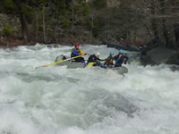
Rafting California's Smith River
 The
Smith River is California's only un dammed river system. It is a jewel
of whitewater with three major forks and countless side creeks. Since
there are no dams, you'll need to go to the Smith when there is water
and that usually means that it is raining. The Smith has a very rocky
watershed, so there is very little soil to store water. If it rains, the
river runs. When it stops raining, you'll have a few days to go rafting
before the water drops.
Most people raft the Smith in November to April after recent rainstorms. February is historically a good month. There are a few rafting outfitters promoting commercial trips on these awesome rivers, but it's tough because trips will often cancel if the water is too low or too high.
Most people that make a pilgrimage to the Smith will run an easier section of whitewater on the Middle Fork or South Fork on their first day before running the Class IV North Fork of the Smith. The North Fork is the highlight of most trips due to spectacular scenery, interesting vegetation, and wonderful rapids. It is one of the best overall river trips in the world.
If you go up there track down a map and try to bring a friend that has been before. There are whitewater rivers of all types everywhere and it's like being a kid at a candy store. More descriptions are available on Whitewater Guidebook.
Many rafting groups hire shuttle drivers like "Bearfoot" Brad at (707) 457-3365.
The North Fork: This is the classic run. The put in shuttle is long, but you are rewarded with a scenic 14 mile float with numerous fun Class IV rapids. The main rapids are Scout Rapid, Ledge, and Serpentine Slide. This section is known for unique scenery and vegetation including the rare carnivorous Pitcher Plant.
The Middle Fork: The Middle Fork of the Smith has many runs on it that parallel Highway 199. There are two low water runs below the Cal Trans station and above the famous Siskiyou Gorge. The Class V Siskiyou Gorge is right next to Highway 199, but you won't see it from the road. Below the gorge is a great section of Class III whitewater with one Class IV, Highway Rapid.
Below this section, you'll pass the confluence with the North Fork and a nice Class II+ section. Most people put in for this run at the Mary Adams bridge and river access. If you're not ready for Class IV+, be sure to take out above Oregon Hole Gorge which is a mile long gorge of solid Class IV+ rapids ending in Oregon Hole Rapid. Below here it's about 20 miles of Class I to the ocean.
The South Fork: Most people put in up the South Fork Road at the Stevens Bridge. This allows for a nice Class III to IV- run with great scenery. This run makes a great warm-up for those doing the North Fork the next day. Most groups will take out above the South Fork Gorge.
The South Fork Gorge is a little more difficult than the Class IV+ Oregon Hole Gorge on the Middle Fork. The drops are a little more continuous and more difficult. Rafters should be ready to run six tough rapids consecutively without scouting. If the water is high, it's crazy in there.
Directions
Most people make Crescent City their home while they are running the Smith River due to the plentiful cheap hotels and plethora of interesting places to eat and party. I'd recommend a visit to Pizza Hut for dinner and Everett's post dinner activities.
To Crescent City: I'll usually take Interstate 5 to Grant's Pass and then get on Highway 199 towards the coast to Crescent City. If you're leaving from San Francisco, you'll probably take Highway 101 all the way up to Crescent City.
For those of you leaving from Sacramento or the Central Valley, don't look at a map and think that it's faster to cross over to Highway 101 via 20 or 299. It's not. Just bite the bullet and drive to Grant's Pass.
To Jedediah Smith Redwoods State Park: If you like to camp in the rain, you'll love Jedediah Smith Redwoods State Park. It's just a quick 15 minute drive up Highway 199 from Crescent City and very well located for boating. Make sure that you bring tarps, good tents, rain jackets, and lots of quarters for the hot showers.
Outfitters
Redwoods & Rides
Disclaimer: River descriptions and classifications may change due to natural events that may create new hazards or flows. C-W-R advises that any paddler that uses this site be additionally informed by seeking out local news and updates for changes on this river.